


- NavIC provides accurate satellite-based navigation, critical for strategic military and civilian purposes.
- The system operates with seven satellites, offering extensive coverage including areas beyond India’s borders.
- Integration with GAGAN enhances reliability by mitigating atmospheric interference.
A recent report in The Indian Express, highlighting Operation Sindoor, stated, “While the spectacular success of India’s multi-layered defence system is commendable, many other homegrown systems and technologies have also performed admirably, providing a decisive edge to the Indian military.” A key feature highlighted in Operation Sindoor was the precision with which India hit targets located deep inside Pakistan, particularly mentioning India’s indigenous navigation and guidance system, NavIC (Navigation with Indian Constellation).
This article discusses in detail this homegrown satellite navigation system, IRNSS or NavIC.
Triangulation Principle

The basic triangulation concept is used to find positional information on board the aircraft. For calculating the position, at least three satellites should be visible to the aircraft receiver.
Range from three satellites can be calculated as follows:
d1 = [{x1 – x}2 + {y1 – y}2 + {z1 – z}2]1/2 + c x Tc,
where d1, d2 and d3 are the distances measured from three satellites, S1, S2 and S3, and x1, y1, and z1 are coordinates of Satellite S1 and x, y, and z are coordinates of the aircraft receiver (unknown variable in this case),
d2 = [{x2 – x}2 + {y2 – y}2 + {z2 – z}2]1/2 + c x Tc,
where x2, y2 and z2 are the coordinates of Satellite S2,
d3 = [{x3 – x}2 + {y3 – y}2 + {z3 – z}2]1/2 + c x Tc,
where x3, y3 and z3 are S3 satellite coordinates.
It may be noted that distance is measured in terms of the time taken by electromagnetic waves to travel from satellite to receiver. The start time is provided by the satellite clock, and the end time is provided by the receiver clock. The atomic clock, provided by satellite, is a very stable clock, but the clock provided in the receiver is not a very stable clock to keep its price low. In addition, satellite clock correction is provided in the navigation message, but the receiver clock has to be corrected in the receiver, so an additional variable, Tc, is added to the matrix to provide this correction. Now we have four variables x, y, z and Tc, so to solve this matrix we need distance from one additional satellite.
d4 = [{x4 – x}2 + {y4 – y}2 + {z4 – z}2]1/2 + c x Tc,
Hence to get precise positional information, minimum four satellites should be visible to the receiver.
NavIC
The IRNSS project was approved by the government of India in 2006, and Constellation’s first satellite (IRNSS-1A) was launched on 1 July 2013. The final satellite (IRNSS-1G) was launched on 28 April 2016, and the system was renamed NavIC by the Prime Minister. NavIC became operational in 2018. The main objective of the system is to provide reliable position, navigation, and timing services over Indian and neighbouring airspace.
NavIC Configuration
System (Fig 2) consists of;
- Space Segment (Satellites)
- Ground Segment &
- User Segment.

Ground Segment
The Ground Segment is responsible for the maintenance and operation of the IRNSS constellation. It comprises of:
- ISRO Navigation Center (INC)
- IRNSS Space Control Facility (SCF)
- IRNSS Range and Integrity Monitoring Station (IRIMS)
- IRNSS Network Timing Center
- IRNSS CDMA Ranging Stations
- Laser Ranging Stations
- Data Communication Network
Space Segment
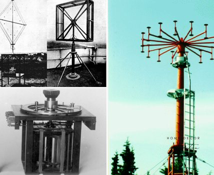
There are seven satellites (3 Satellites are in Geo-Stationary orbit at 34o, 83o and 132o East and 4 Satellites in GEO Synchronous orbits placed at an inclination of 29o with Longitude crossing at 55o and 111o.

Fig 3: Space Segment
User Segment
It consists of specially designed dual frequency receiver. These receivers are designed to receiver other constellations (like GPS etc.) in addition to IRNSS. All the seven IRNSS satellites are continuously tracked by the user receivers within the coverage airspace.
Performance Achieved
The facility has been created to provide two levels of services, Standard Positioning Service (SPS) and Restricted Services (RS) for authorized users. The performance provided is given in Table 1.

Conclusion
IRNSS (NavIC) is a space-based system and hence extends the coverage to about 1500km beyond the borders, whereas the ground-based navigation systems have a limited range (line of sight distance from the system). Also, these systems provide two levels of service: SPS for general aviation (and land vehicles) and Restricted Services (RS) for special requirements. In addition, INRSS, along with GPS Aided GEO Augmented Navigation (GAGAN), can further enhance the performance of the GNSS over Indian and surrounding airspace and also take care of variables like Ionospheric Effect, etc.
Read More: Wipro Acquires LAUAK Stake, Strengthens Global Aerospace Footprint